Guides
Language
EnglishCurrency
US dollar · $GetYourGuide uses the currency you choose.
Guide · Brenta Dolomites
Brenta Dolomites hiking: Molveno and its refuges
Brenta Dolomites hiking starts in a lake village. From Molveno a cable car and a chain of mountain huts lead you under some of the tallest walls in the group, at whatever pace you choose.
Editorial team, hikingdolomitesitaly.comUpdated October 25, 20267 min read67 sources
The refuge trail in brief
The Brenta, an island of rock west of the rest
The Brenta Dolomites are the westernmost part of the Dolomites, on the western edge of the Province of Trento, and cover 11,135 hectares of the World Heritage site.7 They stand apart from the other groups in shape as well as place: erosion has carved them into jagged spires and pinnacles, where much of the eastern Dolomites shows smoother, more fluid lines.8
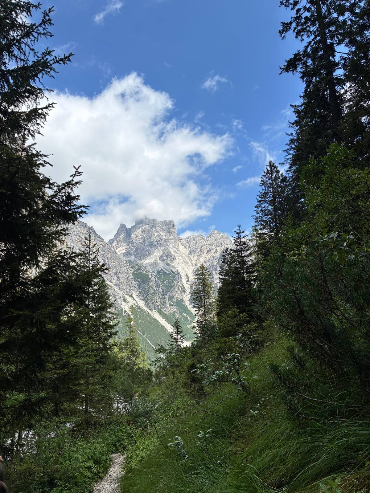
The Bocca di Brenta pass splits the group into a northern and a southern half, with Cima Tosa in the south.9 Among the other high peaks are Cima Brenta and the Campanil Basso, a slim tower that still draws climbers from around the world.10 From Molveno you walk up the Val delle Seghe towards the Bocca di Brenta, to the foot of the walls.
All of it lies inside the Adamello Brenta Natural Park. The park was founded in 1967, together with Paneveggio, as one of the first two provincial parks in Italy, and its protected area has grown to 620.50 square kilometers.1112 For walkers that means marked trails, rules that protect the forest and the wildlife, and huts that are part of the landscape rather than resorts.
The refuge trail
From the lake to the pass, hut by hut
-
Molveno
Cable car to Pradel
Up to the lake terrace at 1,350 m.1
-
After 1 hour
Croz dell'Altissimo
-
40 minutes on
Rifugio Selvata
-
About 2.5 hours
Tosa and Pedrotti
-
20 minutes more
Bocca di Brenta
Molveno and the cable car to Pradel
Molveno sits at the north end of its lake, and the lake itself has a reputation: the 2026 Legambiente and Touring Club Italiano guide placed it first among lake destinations, its eleventh win in that category.16 For hikers the important building is the cable car station. The lift climbs from the village to the Pradel terrace at 1,350 m, in the heart of the park, with a view straight down onto the water.1
In summer 2026 the first section, Molveno to Pradel, runs from 08:00 to 18:45 between 21 June and 7 September, and a second section continues to Palon di Tovre.17 Outside high summer the hours are shorter: 08:30 to 17:45 until 20 June and again from 8 September to 5 October.1819 The lifts open every day from 25 April to 1 November.20
Pradel is where most refuge walks begin. The local tourism office calls it the starting point for high routes to the summits and huts of the Brenta, and you can reach it on foot or by the cable car from the village centre.21 A dense network of trails links the many huts around Molveno, so you can make the day as short or as long as you like.22
The huts
Brenta refuges above Molveno compared
| Refuge | Altitude | Open | From Pradel |
|---|---|---|---|
| La Montanara | On the plateau | Late May to early Oct | On the plateau23 |
| Croz dell'Altissimo | 1,435 m | Early May to late Sep | 1 hr, path 34013242 |
| Selvata | 1,630 m | 1 Jun to 20 Sep | About 1.5 hrs42526 |
| Tosa & Pedrotti | 2,449 m | Mid-Jun to late Sep | About 3.5 hrs6527 |
Altitudes, seasons and times as Visit Trentino and Molveno tourism publish them; call the hut before you go.1346
And the 900-metre wall here, one of the highest and most impressive in the Brenta, puts the toughest climbers to the test.
La Montanara and Croz dell'Altissimo
La Montanara is the hut on the Pradel plateau itself, family-run and popular with children, who can play safely on its meadow.23 In summer it opens every day from late May to the first Sunday in October; from Molveno you can walk up on path 352 in about 1.5 hours instead of riding.2329 From there the Delle grotte footpath reaches Croz dell'Altissimo in 1 hour.30
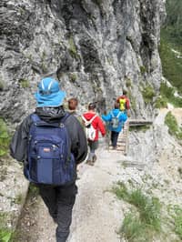
Rifugio Croz dell'Altissimo stands at 1,435 m on the main eastern approach to the Brenta, at the foot of the rock face that gives it its name.13 That wall rises 900 m, one of the highest in the group.28 From Pradel the walk on path 340 takes about 1 hour and is graded T, the easiest level; from Molveno up the Val delle Seghe on path 319 it is 1.5 hours, grade E.231
The hut opens from early May to late September, and at weekends in October.24 Visit Trentino asks every walker to call the manager before setting out to make sure the hut is really open, a sensible habit for any refuge in the shoulder months.25 A paid taxi also runs to Croz dell'Altissimo, which helps if someone in your group cannot walk the whole way.31
Map
Seceda, Val Gardena, the Brenta above Molveno and the way in
The Seceda crest up close, the villages and lifts of Val Gardena, the refuge path from Molveno into the Brenta, then the airports and stations you arrive at.
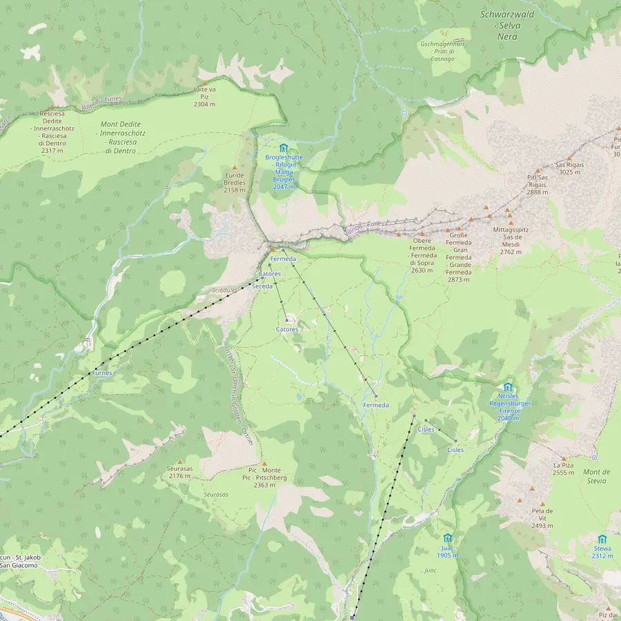 1Seceda summit2Furnes3Pieralongia4Fermeda hut5Col Raiser6Forcella de Mesdì
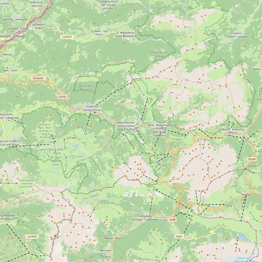 7Ortisei8Santa Cristina9Selva10Resciesa11Sassolungo12Compatsch13Puez hut14Passo Sella
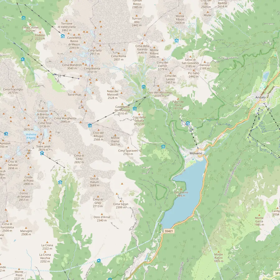 15Molveno16Pradel17La Montanara18Croz dell'Altissimo19Selvata20Tosa and Pedrotti21Lake Molveno
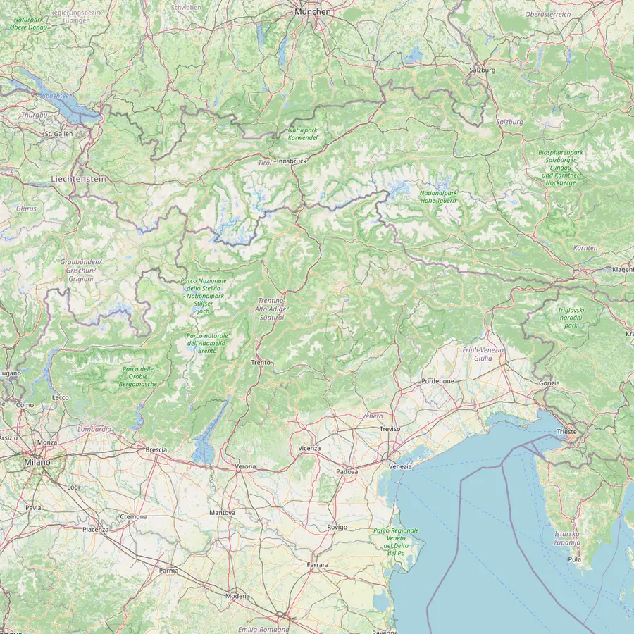 22Venice airport23Verona airport24Trento25Bolzano26Ponte Gardena27Innsbruck airport
- 1Seceda summit
The summit cross at 2,519 m, reached on the Ridge Line trail from the top station.3233
In Google Maps ↗ - 2Furnes
Middle station between Ortisei and Seceda: a 2,500 m gondola below, a 2,050 m cable car above.34
In Google Maps ↗ - 3Pieralongia
Hut at the foot of the stone teeth, about 45 minutes on foot from the Seceda top station.35
In Google Maps ↗ - 4Fermeda hut
On the Trojer loop, near the Fermeda chairlift, which runs 20 June to 20 September in 2026.3637
In Google Maps ↗ - 5Col Raiser
Gondola top station at 2,106 m above Santa Cristina; 1 to 2 hours on foot to the top of Seceda.3839
In Google Maps ↗ - 6Forcella de Mesdì
Steep pass at 2,597 m on the long traverse from Resciesa.40
In Google Maps ↗ - 7Ortisei
Village at 1,236 m and start of the Seceda cable cars and the Alpe di Siusi gondola.4142
In Google Maps ↗ - 8Santa Cristina
Village at 1,428 m with the Col Raiser gondola.43
In Google Maps ↗ - 9Selva
Highest village of the valley, with the Dantercëpies gondola towards the Puez plateau.44
In Google Maps ↗ - 10Resciesa
Funicular top station above Ortisei at 2,103 m; easy walks along the ridge.4045
In Google Maps ↗ - 11Sassolungo
The circuit round the group takes 5.5 hours, about 3 with the lifts.4647
In Google Maps ↗ - 12Compatsch
Top of the Seiser Alm cableway from Seis, a 15-minute ride.48
In Google Maps ↗ - 13Puez hut
Refuge at 2,475 m on the Puez plateau.49
In Google Maps ↗ - 14Passo Sella
End point of the Stone City section of the Sassolungo circuit.50
In Google Maps ↗ - 15Molveno
Lake village and start of the cable car to Pradel.1
In Google Maps ↗ - 16Pradel
Lift terrace at 1,350 m above the lake and start of the refuge paths.121
In Google Maps ↗ - 17La Montanara
Family-run refuge on the Pradel plateau, open daily from late May.23
In Google Maps ↗ - 18Croz dell'Altissimo
Refuge at 1,435 m below a 900 m rock wall, 1 hour from Pradel on path 340.13282
In Google Maps ↗ - 19Selvata
Refuge at 1,630 m, open 1 June to 20 September.425
In Google Maps ↗ - 20Tosa and Pedrotti
Huts at 2,449 m close to the Bocca di Brenta, open mid-June to late September.5
In Google Maps ↗ - 21Lake Molveno
Placed first among lake destinations in the 2026 Legambiente and Touring Club guide.16
In Google Maps ↗ - 22Venice airport
About 270 km from Val Gardena.51
In Google Maps ↗ - 23Verona airport
About 190 km from Val Gardena, with an AltoAdigeBus link.5253
In Google Maps ↗ - 24Trento
Main station for Molveno; the Paganella bus runs every 30 minutes.5455
In Google Maps ↗ - 25Bolzano
Station 40 km from Val Gardena; bus 350 runs up the valley.56
In Google Maps ↗ - 26Ponte Gardena
The closest station to Val Gardena, 18 km away.56
In Google Maps ↗ - 27Innsbruck airport
About 120 km from Val Gardena.52
In Google Maps ↗
Checklist
For the refuge trail
Before
- Hut opening dates checked
- Money for the cable car
- Local forecast read
In your pack
- Boots, rain jacket, first-aid kit
- Water and snacks
- The park's bear quick guide
Plan your budget
What a guided day costs your group
Pick a guided day and the number of people
Total from$70
per traveler from $35
Check availabilityfree cancellationGroup totals here take the cheapest per-head fare on GetYourGuide for each Brenta or Val Gardena outing and multiply it by your party; currency conversion uses the ECB's daily reference, and checkout states the real total.
Video
Walking in the Brenta Dolomites
The video starts loading once you tap play.
Selvata and the climb to the Bocca di Brenta
About 40 minutes beyond Croz dell'Altissimo, on the other side of the valley, Rifugio Selvata sits on a green plateau at 1,630 m at the foot of the Massodi.34 From its terrace the face of Croz dell'Altissimo is 900 m of vertical rock, the wall that drew the hardest climbers of the early 20th century.57 The hut opens from 1 June to 20 September.25
Selvata is a natural turning point for a day walk: from Molveno on path 319 via Croz dell'Altissimo it is 2 hours, from Pradel on paths 340 and 319 about 1.5 hours.26 Above it the valley narrows and steepens, and the path climbs for about 2.5 hours to the Tosa and Pedrotti huts, with another 20 minutes to the Bocca di Brenta pass.14
Those upper huts stand at 2,449 m and open from mid-June to late September.56 Their story is the story of Brenta mountaineering: the first crossing of the Bocca di Brenta was made in 1864, and later the SAT built Rifugio Tosa while the Bremen alpine club built Rifugio Tommaso Pedrotti close by.15 From Pradel the whole way up takes about 3.5 hours; from Molveno on path 319 about 4.5 hours.2758
Rifugio hiking in the Dolomites: how the huts work
A refuge in the Brenta is a staffed mountain hut with a kitchen, a terrace and, at the larger ones, beds. Rifugio hiking in the Dolomites means planning your day around them: lunch at one, coffee at the next, and the walls getting closer in between. Most cook regional dishes, and on a sunny day the terraces fill up around midday, so an early start pays off twice.
Seasons differ between the huts, and the dates above are the huts' own, as published by Visit Trentino. Selvata, for example, opens 1 June, while the high huts by the pass wait until mid-June.255 If you want to sleep up there, bookings through Visit Trentino can be cancelled free up to 30 days before arrival, with a 50% fee after that.59
Beyond the Bocca di Brenta the Bocchette Centrali begin, a high via ferrata graded EEA that crosses the whole group to Passo del Grostè in two or more days.60 That is climbing terrain with a harness, helmet and experience. For walkers, the pass is the turning point: enjoy the view, then head back down to the huts.
The guided day from Molveno
If you would rather not plan it yourself, our guided day covers the lower half of this trail. The listing names the Pradel plateau, La Montanara, Croz dell'Altissimo and Selvata, then the walk back down to Molveno in the afternoon, over 6.5 hours. You meet at the ticket office, on the ground level.
It costs from $35 and is rated 4.71 from 19 reviews. The guide is included; the cable car ticket and lunch are not, so budget for both, and the huts are where lunch happens. Guides speak Italian and English. If English matters to you, say so when you book, and keep in mind that a group mixing both languages will hear some of each.
The listing asks for a moderate level of fitness, and it is not suitable for children under 8 or for people with mobility impairments. Bring sunglasses, a sun hat, snacks, sunscreen, water and proper trekking gear. Free cancellation up to 24 hours before and reserve now, pay later make it easy to pick a date and watch the forecast.
Bears, weather and safety in the park
The Adamello Brenta park is bear country. The park itself describes the brown bear as a significant presence in the park and across Trentino, and publishes a quick guide with the essential rules of behaviour and the emergency number 112.6162 Read it before you go; it takes a few minutes and tells you what to do if you meet one.
The weather is the other thing to watch. Trentino's mountain rescue advises reading the weather reports, especially the local ones, before every walk, and going back the way you came if tiredness, doubt or bad weather sets in.6364 Leave your route and your planned return time with a friend or the hut manager before you set off.65
Carry what the rescue service lists for any trek: proper boots, a water bottle, a rain jacket, food, a headlamp, spare batteries and a first-aid kit.66 In an accident call 112 and give your exact position, the number of people involved and the weather where you are.67 With that in your pack, the lower refuge trail is a relaxed and very beautiful day.
Your Brenta day
Walk to the refuges under the Brenta walls.
Pick a date, meet at the ticket office, and cancel free if the forecast turns.


You ask,we answer.
How do I start hiking in the Brenta from Molveno?
Take the cable car to Pradel. It climbs to 1,350 m; path 340 then reaches Croz dell'Altissimo in about 1 hour.12
How high is Rifugio Selvata?
1,630 m. It stands on a green plateau at the foot of the Massodi, open 1 June to 20 September.425
How long from Molveno to the Bocca di Brenta?
About 4.5 hours to the huts below it. Path 319 to the Tosa and Pedrotti huts takes 4.5 hours; the pass is 20 minutes further.5814
When are the Brenta refuges open?
Roughly late spring to late September. Croz dell'Altissimo opens in early May, Selvata on 1 June, the high huts in mid-June.24255
Is the cable car included in the guided tour?
No. The listing excludes the cable car ticket and lunch; the guide is included.
Are there bears in the Brenta?
Yes, brown bears live in the park. The park publishes a quick guide with the rules of behaviour and the number 112.6162
Can children do the guided day?
Not under 8. The listing excludes children under 8 and asks for a moderate level of fitness.
Sources
Sources and evidence
- 1Molveno Holiday, the Molveno tourism consortiumTake the cable car to see the lake from above↩
- 2Visit Trentino (Trentino Marketing)Croz dell'Altissimo mountain hut, Molveno↩
- 3Visit Trentino (Trentino Marketing)Croz dell'Altissimo mountain hut, Molveno↩
- 4Visit Trentino (Trentino Marketing)Selvata mountain hut, Molveno↩
- 5Visit Trentino (Trentino Marketing)Tosa Tommaso Pedrotti mountain hut↩
- 6Visit Trentino (Trentino Marketing)Tosa Tommaso Pedrotti mountain hut↩
- 7UNESCO Dolomites Foundation (Fondazione Dolomiti UNESCO)Brenta Dolomites: the 9th System↩
- 8UNESCO Dolomites Foundation (Fondazione Dolomiti UNESCO)Brenta Dolomites: the 9th System↩
- 9UNESCO Dolomites Foundation (Fondazione Dolomiti UNESCO)Brenta Dolomites: the 9th System↩
- 10UNESCO Dolomites Foundation (Fondazione Dolomiti UNESCO)Brenta Dolomites: the 9th System↩
- 11Adamello Brenta Natural Park (Parco Naturale Adamello Brenta)Storia (history of the park)↩
- 12Adamello Brenta Natural Park (Parco Naturale Adamello Brenta)Storia (history of the park)↩
- 13Visit Trentino (Trentino Marketing)Croz dell'Altissimo mountain hut, Molveno↩
- 14Visit Trentino (Trentino Marketing)Selvata mountain hut, Molveno↩
- 15Visit Trentino (Trentino Marketing)Tosa Tommaso Pedrotti mountain hut↩
- 16Molveno Holiday, the Molveno tourism consortiumThe most beautiful lake in Italy↩
- 17Molveno Holiday, the Molveno tourism consortiumTake the cable car to see the lake from above↩
- 18Molveno Holiday, the Molveno tourism consortiumTake the cable car to see the lake from above↩
- 19Molveno Holiday, the Molveno tourism consortiumTake the cable car to see the lake from above↩
- 20Molveno Holiday, the Molveno tourism consortiumTake the cable car to see the lake from above↩
- 21Molveno Holiday, the Molveno tourism consortiumHiking in the Brenta Dolomites↩
- 22Molveno Holiday, the Molveno tourism consortiumHiking in the Brenta Dolomites↩
- 23Molveno Holiday, the Molveno tourism consortiumRifugio La Montanara↩
- 24Visit Trentino (Trentino Marketing)Croz dell'Altissimo mountain hut, Molveno↩
- 25Visit Trentino (Trentino Marketing)Selvata mountain hut, Molveno↩
- 26Visit Trentino (Trentino Marketing)Selvata mountain hut, Molveno↩
- 27Visit Trentino (Trentino Marketing)Tosa Tommaso Pedrotti mountain hut↩
- 28Visit Trentino (Trentino Marketing)Croz dell'Altissimo mountain hut, Molveno↩
- 29Visit Trentino (Trentino Marketing)La Montanara mountain hut, Molveno↩
- 30Molveno Holiday, the Molveno tourism consortiumRifugio La Montanara↩
- 31Visit Trentino (Trentino Marketing)Croz dell'Altissimo mountain hut, Molveno↩
- 32Dolomites Val Gardena tourism (Val Gardena Marketing)Seceda↩
- 33Dolomites Val Gardena tourism (Val Gardena Marketing)Seceda Ridge Line↩
- 34Seceda AG cableways (Funivie Seceda), OrtiseiSummer: lifts, opening hours and prices↩
- 35Seceda AG cableways (Funivie Seceda), OrtiseiHiking in the Puez-Odle nature park↩
- 36Seceda AG cableways (Funivie Seceda), OrtiseiHiking in the Puez-Odle nature park↩
- 37Dolomites Val Gardena tourism (Val Gardena Marketing)Lifts in Val Gardena: summer opening times↩
- 38Dolomites Val Gardena tourism (Val Gardena Marketing)The 7 most beautiful hikes↩
- 39Dolomites Val Gardena tourism (Val Gardena Marketing)The way to the Seceda↩
- 40Dolomites Val Gardena tourism (Val Gardena Marketing)The 7 most beautiful hikes↩
- 41Dolomites Val Gardena tourism (Val Gardena Marketing)The 7 most beautiful hikes↩
- 42Dolomites Val Gardena tourism (Val Gardena Marketing)Lifts in Val Gardena: summer opening times↩
- 43Dolomites Val Gardena tourism (Val Gardena Marketing)The 7 most beautiful hikes↩
- 44Dolomites Val Gardena tourism (Val Gardena Marketing)The 7 most beautiful hikes↩
- 45Dolomites Val Gardena tourism (Val Gardena Marketing)The 7 most beautiful hikes↩
- 46Dolomites Val Gardena tourism (Val Gardena Marketing)The 7 most beautiful hikes↩
- 47Dolomites Val Gardena tourism (Val Gardena Marketing)The 7 most beautiful hikes↩
- 48Dolomites Region Seiser Alm tourism (Seiser Alm Marketing)The Seiser Alm Aerial Cableway in summer↩
- 49Dolomites Val Gardena tourism (Val Gardena Marketing)The 7 most beautiful hikes↩
- 50Dolomites Val Gardena tourism (Val Gardena Marketing)The 7 most beautiful hikes↩
- 51Dolomites Val Gardena tourism (Val Gardena Marketing)Arrival by plane or helicopter↩
- 52Dolomites Val Gardena tourism (Val Gardena Marketing)Arrival by plane or helicopter↩
- 53Dolomites Val Gardena tourism (Val Gardena Marketing)Arrival by plane or helicopter↩
- 54Visit Trentino (Trentino Marketing)How to get to Trentino↩
- 55Molveno Holiday, the Molveno tourism consortiumHow to get to Molveno↩
- 56Dolomites Val Gardena tourism (Val Gardena Marketing)Arrival by train↩
- 57Visit Trentino (Trentino Marketing)Selvata mountain hut, Molveno↩
- 58Visit Trentino (Trentino Marketing)Tosa Tommaso Pedrotti mountain hut↩
- 59Visit Trentino (Trentino Marketing)Tosa Tommaso Pedrotti mountain hut↩
- 60Visit Trentino (Trentino Marketing)Tosa Tommaso Pedrotti mountain hut↩
- 61Adamello Brenta Natural Park (Parco Naturale Adamello Brenta)Coesistere con l'orso (living with the bear)↩
- 62Adamello Brenta Natural Park (Parco Naturale Adamello Brenta)Coesistere con l'orso (living with the bear)↩
- 63Visit Trentino (Trentino Marketing)What to do during a mountain hike (10 rules)↩
- 64Visit Trentino (Trentino Marketing)What to do during a mountain hike (10 rules)↩
- 65Visit Trentino (Trentino Marketing)What to do during a mountain hike (10 rules)↩
- 66Visit Trentino (Trentino Marketing)What to do during a mountain hike (10 rules)↩
- 67Visit Trentino (Trentino Marketing)What to do during a mountain hike (10 rules)↩
Keep reading