 No car needed
Train and bus
Via Bolzano or Trento
- To Val Gardena
- Bus 350
- To Molveno
- Bus every 30 minutes
- Local buses
- Free with guest cards
Guides
Language
EnglishCurrency
US dollar · $GetYourGuide uses the currency you choose.
Guide · Getting there
How to get to the Dolomites depends on where you want to walk. Val Gardena is reached from Bolzano and the Brenner line, Molveno from Trento. Here are the airports, trains, buses and roads for both.
Editorial team, hikingdolomitesitaly.comUpdated October 25, 20266 min read49 sources
Quick answer
The Dolomites spread over a large area of north-east Italy: the nine mountain groups of the World Heritage site are scattered like an archipelago across a far greater alpine area.6 So the useful question is not how to reach the Dolomites in general but how to reach the valley you will sleep in. This page covers two bases with very different routes in: Val Gardena in South Tyrol and Molveno in the Brenta group of Trentino.
Val Gardena opens off the Isarco valley, the main road and rail corridor that runs south from the Brenner Pass through Bolzano. Molveno lies further west and south, reached from Trento in the Adige valley. Both corridors carry the A22 motorway, which runs the length of the Adige valley and links with the A1 and the A4 in the south.7
That geography explains the rest of this guide. If you fly into Innsbruck or Munich, you come down the Brenner line and Val Gardena is the natural base. If you fly into Verona or Bergamo, Trento and Molveno are closer. Venice works for both, but neither is close. Decide where you want to walk first, then work backwards to the airport, and the rest of the journey falls into place.
Val Gardena tourism lists the closest airports as Bolzano, Innsbruck, Verona, Munich, Bergamo, Venice and Milan.8 By its count Bolzano is 40 km away, Innsbruck 120 km, Verona 190 km, Bergamo and Venice 270 km each, Munich 300 km and Milan Malpensa 350 km.1 Treviso is 230 km.2
For Trentino, Visit Trentino names Verona, Bergamo, Venice and Milan as the nearest airports and says you can be in the province in one or two hours by rental car, bus, shuttle or train.9 For a Molveno trip that makes Verona the simplest choice, with Bergamo and Venice close behind.
Bolzano is the closest airport of all to Val Gardena, but check which routes fly there in your season; many travelers from outside Europe land at one of the larger airports and continue by train or bus. Check the onward connection before you book: an arrival in the late evening can mean a night near the airport rather than in the mountains.
How far
Airports compared
| Airport | Distance | Onward |
|---|---|---|
| Bolzano | 40 km | Bus, taxi or transfer1 |
| Innsbruck | 120 km | AltoAdigeBus or train110 |
| Verona | 190 km | AltoAdigeBus or train110 |
| Treviso | 230 km | Transfer or taxi211 |
| Venice | 270 km | Transfer or taxi111 |
| Bergamo | 270 km | AltoAdigeBus110 |
| Munich | 300 km | AltoAdigeBus or train110 |
| Milan Malpensa | 350 km | Transfer or taxi111 |
Road distances as Val Gardena tourism gives them; times depend on traffic and connections.12
Three ways in
It depends on which part you mean. Val Gardena tourism puts Venice Marco Polo airport 270 km from the valley.2 The van day described below heads for the eastern Dolomites around Cortina instead, which is the part of the range you can see from Venice and still be back for dinner.
A good example is a guided van trip from Piazzale Roma in Venice, a 9-hour day that drives 100 minutes to Pieve di Cadore, then visits Auronzo Lake, Lake Misurina and Cortina d'Ampezzo before heading back. It costs from $171 and is rated 4.88 from 1,050 reviews, with free cancellation up to 24 hours before. It is sightseeing with short walks, not a hike, but it shows you the scenery in a single day without a car.
If you want to walk properly, plan at least one night in a mountain valley. A day trip spends much of its time on the road, and the best light on the rock comes early and late, when day visitors are still travelling. From Venice, the van trip is a taste; a few nights in Val Gardena or Molveno are the real thing.
Map
The Seceda crest up close, the villages and lifts of Val Gardena, the refuge path from Molveno into the Brenta, then the airports and stations you arrive at.
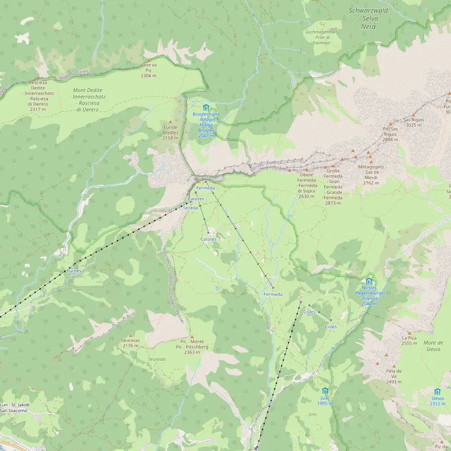 1Seceda summit2Furnes3Pieralongia4Fermeda hut5Col Raiser6Forcella de Mesdì
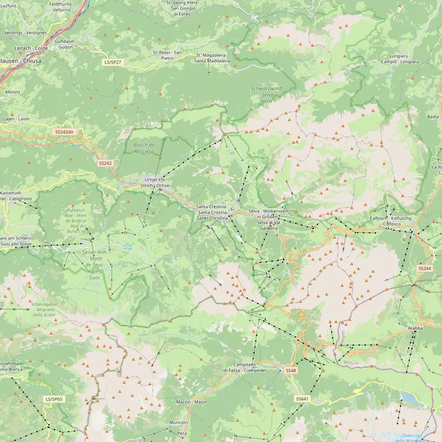 7Ortisei8Santa Cristina9Selva10Resciesa11Sassolungo12Compatsch13Puez hut14Passo Sella
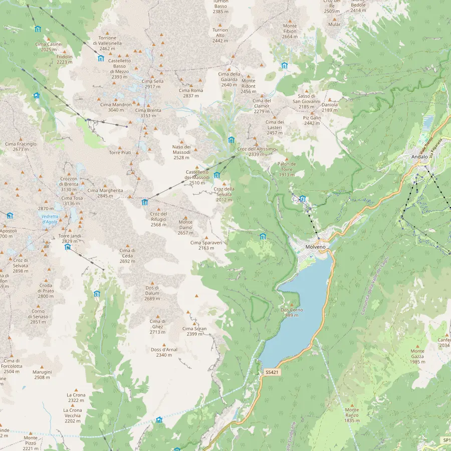 15Molveno16Pradel17La Montanara18Croz dell'Altissimo19Selvata20Tosa and Pedrotti21Lake Molveno
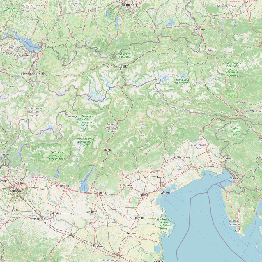 22Venice airport23Verona airport24Trento25Bolzano26Ponte Gardena27Innsbruck airport
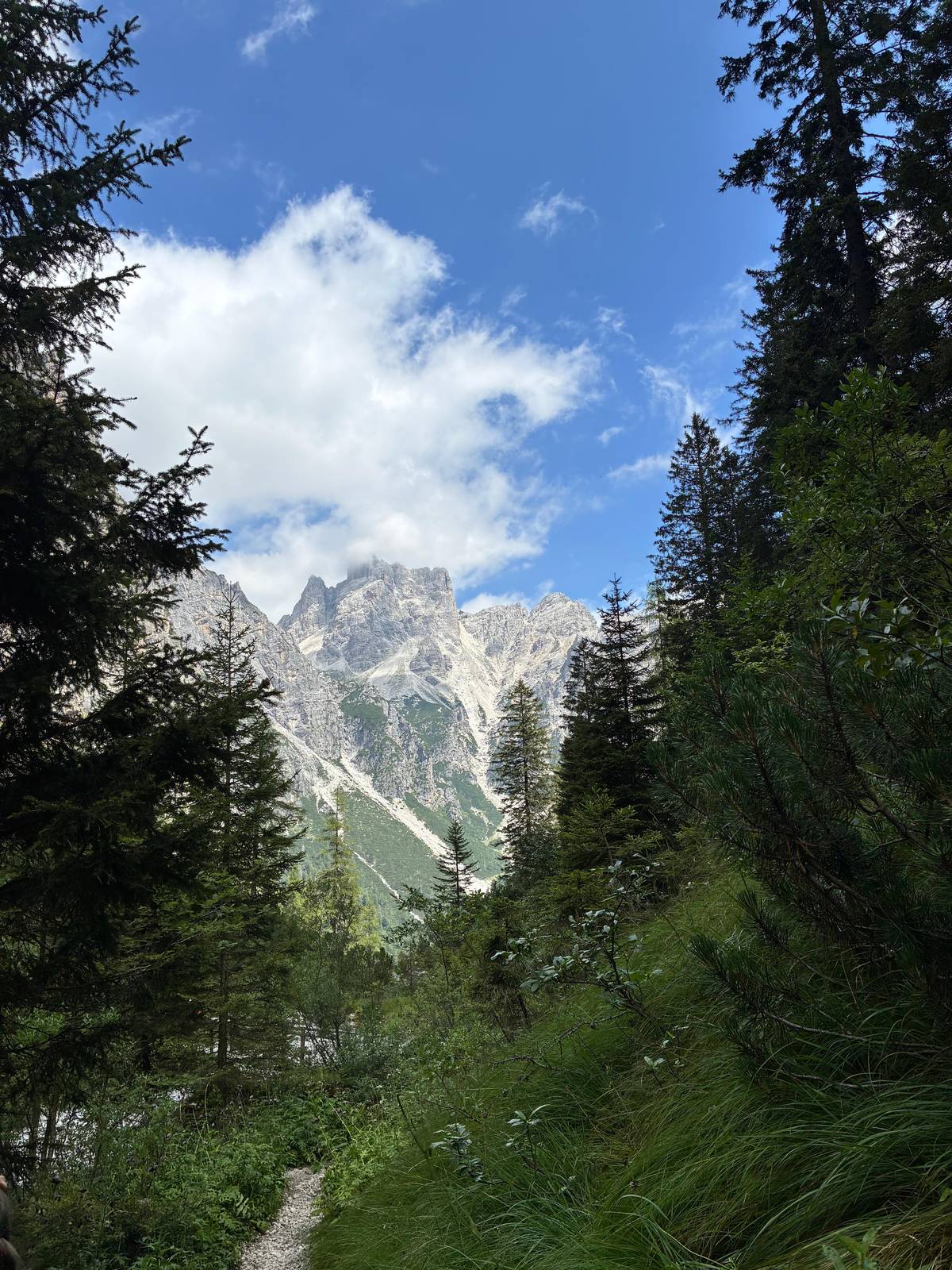
The summit cross at 2,519 m, reached on the Ridge Line trail from the top station.1718
In Google Maps ↗Middle station between Ortisei and Seceda: a 2,500 m gondola below, a 2,050 m cable car above.19
In Google Maps ↗Hut at the foot of the stone teeth, about 45 minutes on foot from the Seceda top station.20
In Google Maps ↗On the Trojer loop, near the Fermeda chairlift, which runs 20 June to 20 September in 2026.2122
In Google Maps ↗Gondola top station at 2,106 m above Santa Cristina; 1 to 2 hours on foot to the top of Seceda.2324
In Google Maps ↗Steep pass at 2,597 m on the long traverse from Resciesa.25
In Google Maps ↗Village at 1,236 m and start of the Seceda cable cars and the Alpe di Siusi gondola.2627
In Google Maps ↗Village at 1,428 m with the Col Raiser gondola.28
In Google Maps ↗Highest village of the valley, with the Dantercëpies gondola towards the Puez plateau.29
In Google Maps ↗Funicular top station above Ortisei at 2,103 m; easy walks along the ridge.2530
In Google Maps ↗The circuit round the group takes 5.5 hours, about 3 with the lifts.3132
In Google Maps ↗Top of the Seiser Alm cableway from Seis, a 15-minute ride.33
In Google Maps ↗Refuge at 2,475 m on the Puez plateau.34
In Google Maps ↗End point of the Stone City section of the Sassolungo circuit.35
In Google Maps ↗Lake village and start of the cable car to Pradel.36
In Google Maps ↗Lift terrace at 1,350 m above the lake and start of the refuge paths.3637
In Google Maps ↗Family-run refuge on the Pradel plateau, open daily from late May.38
In Google Maps ↗Refuge at 1,435 m below a 900 m rock wall, 1 hour from Pradel on path 340.394041
In Google Maps ↗Refuge at 1,630 m, open 1 June to 20 September.4243
In Google Maps ↗Huts at 2,449 m close to the Bocca di Brenta, open mid-June to late September.44
In Google Maps ↗Placed first among lake destinations in the 2026 Legambiente and Touring Club guide.45
In Google Maps ↗About 270 km from Val Gardena.2
In Google Maps ↗About 190 km from Val Gardena, with an AltoAdigeBus link.110
In Google Maps ↗Main station for Molveno; the Paganella bus runs every 30 minutes.464
In Google Maps ↗Station 40 km from Val Gardena; bus 350 runs up the valley.3
In Google Maps ↗The closest station to Val Gardena, 18 km away.3
In Google Maps ↗About 120 km from Val Gardena.1
In Google Maps ↗Checklist
Day trips
Choose a day trip and how many of you are going
Total from$342
per traveler from $171
Check availabilityfree cancellationGroup totals here take the cheapest per-head fare on GetYourGuide for each Brenta or Val Gardena outing and multiply it by your party; currency conversion uses the ECB's daily reference, and checkout states the real total.
Video
The video starts loading once you tap play.
The nearest stations to Val Gardena are Bolzano at 40 km, Ponte Gardena at 18 km, Chiusa at 23 km and Bressanone at 34 km.3 Bus 350 runs between Bolzano, Ponte Gardena or Bressanone and Val Gardena.12 From Munich, direct EC and Railjet trains reach Bolzano or Bressanone in less than four hours.16
Once you arrive, many hotels and guesthouses in Val Gardena give you the Val Gardena Guest Pass, which makes public transport in South Tyrol free during your stay, including the days you arrive and leave.13 That is a strong reason to come by train: the bus up from the station costs you nothing, and so do the buses between the villages and trailheads. Keep the pass or the card in your pocket on the first day, because drivers and lift staff may ask to see it.
Buses also come from the airports directly. AltoAdigeBus connects the Innsbruck, Munich, Verona and Bergamo airports with Val Gardena, and bus transfers and taxis serve Milan Malpensa, Bergamo, Verona, Venice, Treviso, Munich, Salzburg and Innsbruck several times a day.1011 Book shared transfers ahead in high summer.
Trento and Rovereto are the two main train stations in Trentino.46 For Molveno, Trento is the one you want. From there the Paganella Bye Bye Car bus runs directly every 30 minutes between 6:20 am and 11:00 pm and reaches the Paganella plateau in 1 hour 10 minutes, with no change.4
Once there, the Dolomiti Paganella Guest Card makes all public transport around Molveno free.14 Ask your accommodation whether it gives you the card; it turns the bus and local services into part of your stay rather than an extra cost.
By car, leave the A22 at San Michele all'Adige and follow the SS 43 through Mezzolombardo; from Riva del Garda take the SS 421 via Ponte Arche.47 Molveno tourism warns against the road from Vezzano to Ranzo that many navigation apps suggest, because beyond Ranzo it is no longer passable for cars.48
Driving is straightforward. From the north, drive via Innsbruck and the Brenner Pass, leave the A22 at Chiusa, and Ortisei is about 20 minutes and 20 km away; Santa Cristina is 28 km and Selva 32 km from the exit.5 From the south, leave the motorway at Bolzano Nord and follow the signs to Ponte Gardena and the valley.
Parking is the catch. Near the Seceda lift in Ortisei it is limited, and the lift company itself recommends arriving by public transport.15 On the Alpe di Siusi, private cars may only drive up under certain conditions.49 A car is useful for reaching the valley and for moving between valleys, but within Val Gardena the buses and lifts do the work better.
If you combine both bases, the car becomes more useful. Moving between them means driving down to Bolzano and south on the A22 to Trento, then up to Molveno.7 Plan that as a travel day, not as a hiking day, and save the walking for the morning after, when you can start fresh from the new valley.
If you wonder how to get to the Dolomites from Milan, the answer is usually by train to Verona and then north on the Brenner line to Trento or Bolzano. By road, Milan Malpensa is 350 km from Val Gardena and Bergamo 270 km.1 Both airports also have bus transfers and taxis to the valley several times a day.11
From Lake Garda, Molveno is the near end of the Dolomites: Molveno tourism gives the road from Riva del Garda as the SS 421 via Ponte Arche.47 If you are staying on the lake without a car, a guided coach day from Desenzano del Garda runs into the Dolomites for 10 hours, from $98, rated 4.65 from 632 reviews.
Whichever route you take, aim to arrive in daylight. Mountain roads are slower than the map suggests, and the first view of the walls from the valley is worth seeing with your eyes open. Then leave the car and use your boots.
Your Brenta day
Pick a date, meet at the ticket office, and cancel free if the forecast turns.
Bolzano, for Val Gardena. It is 40 km from Val Gardena; Innsbruck is 120 km away and Verona 190 km.1
About 270 km to Val Gardena. That is Val Gardena tourism's figure from Venice Marco Polo airport; Cortina is nearer.2
Yes, to Bolzano, Ponte Gardena or Bressanone. Then take bus 350 up the valley; Ponte Gardena is the closest station at 18 km.312
Train to Trento, then the bus. The Paganella Bye Bye Car bus runs every 30 minutes and takes 1 hour 10 minutes.4
Often, with a guest card. The Val Gardena Guest Pass and the Dolomiti Paganella Guest Card both cover local public transport.1314
Chiusa, from the north. From Chiusa it is about 20 minutes to Ortisei; from the south use Bolzano Nord.5
Yes, by van to Cortina and two lakes. It lasts 9 hours with stops at two lakes and Cortina, and is rated 4.88 from 1,050 reviews.
Sources
Keep reading